Array
(
    [content] => 
    [params] => Array
        (
            [0] => /forum/index.php?threads/tsm-intel-fighting-over-water.17698/page-4
        )

    [addOns] => Array
        (
            [DL6/MLTP] => 13
            [Hampel/TimeZoneDebug] => 1000070
            [SV/ChangePostDate] => 2010200
            [SemiWiki/Newsletter] => 1000010
            [SemiWiki/WPMenu] => 1000010
            [SemiWiki/XPressExtend] => 1000010
            [ThemeHouse/XLink] => 1000970
            [ThemeHouse/XPress] => 1010570
            [XF] => 2021370
            [XFI] => 1050270
        )

    [wordpress] => /var/www/html
)

TSM, Intel fighting over water

It's crazy to build a housing community in the desert. It's as crazy as to grow Alfalfa in Arizona just because it can make money.
There are a lot of crazy things that humanity has done. Some of them seemed crazy at the time --- trying to build a flying machine around 1900 comes to mind --- but now they make sense. Some don't make sense at first glance, but do if you look a bit more closely. Some do make sense at first glance, but don't if you look a bit more closely.

It's crazy to build in places where wildfire risk is high. (California and the New Jersey Pine Barrens)

It's crazy to build in places where the risk of earthquakes is high. (California and Japan)

It's crazy to build in places at or below sea level, where land is subsiding and the risk of flooding is high. (New Orleans)

It's crazy to build in places where the risk of hurricanes is high. (Florida and Carribean islands)

It's crazy to build on coastal barrier islands, where the seashore is washing away and the risk of erosion is high.

It's crazy to build in the desert, where the risk of... now what was the issue again? Oh, right, water. Risk of running out of water? Hmm. Depends where you get the water from.

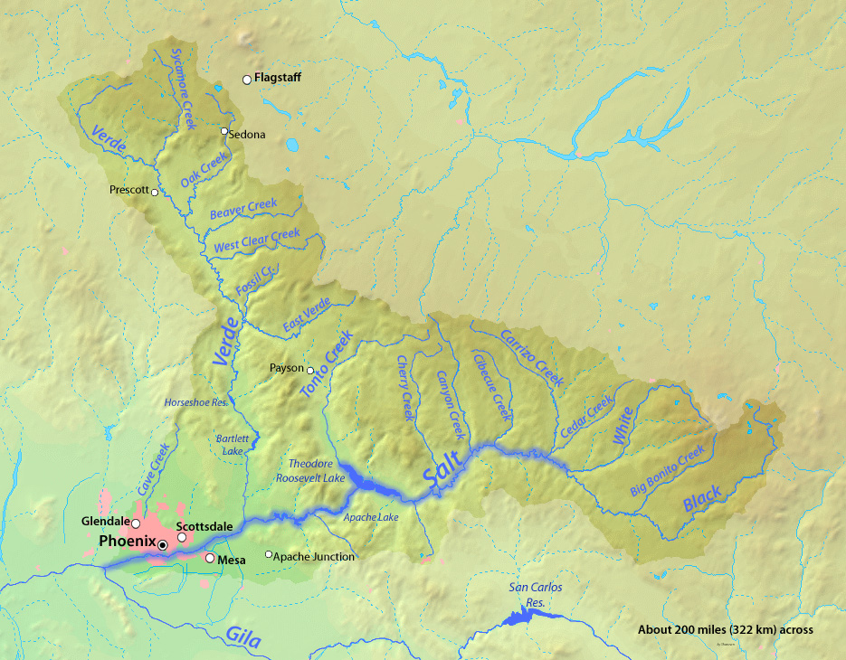
The Salt River Project was formed in 1903, nine years before Arizona became a state, and construction soon started on what became the Theodore Roosevelt Dam and Reservoir (Arizona's largest reservoir), completed in 1911. At the time, Maricopa County --- containing what is now the vast bulk of the Phoenix metropolitan area --- had a population of about 35,000.

1683086539891.png


Between 1923 and 1946, SRP constructed another three dams on the Salt River and two dams on the Verde River, which joins the Salt River just a few miles northeast of the city of Mesa. The Salt River watershed (including the Verde watershed), drains about 13,700 square miles in central Arizona, a little larger than the state of Maryland.

The city of Phoenix planned for its water supply, although primarily for agricultural use, and as agriculture has converted to urban use, the water usage has gone down in general.


Southern California gets much of its water from the Colorado River. The city of Los Angeles drained the Owens Valley for one of its sources of water. San Diego gets about 50% of its water from the Colorado river. LA and San Diego are technically not in the desert.

Who has the more secure water source? Hard to say. SRP's water supply is less overutilized, from what I can tell from my research..

Anyway, the larger metropolitan areas in Arizona are covered by Active Management Areas (AMAs) created in Arizona's 1980 Groundwater Management Act. (The article hist78 linked to mentions the Groundwater Management Act.) The AMAs regulate groundwater withdrawals -- except for the "wildcat subdivisions" loophole (also mentioned in the same article). The rest of the state outside the AMAs is more or less a free-for-all, and they're at risk for depleting their groundwater resources.

AMAs_and_INAs_2023.jpg
 

[excerpt:]

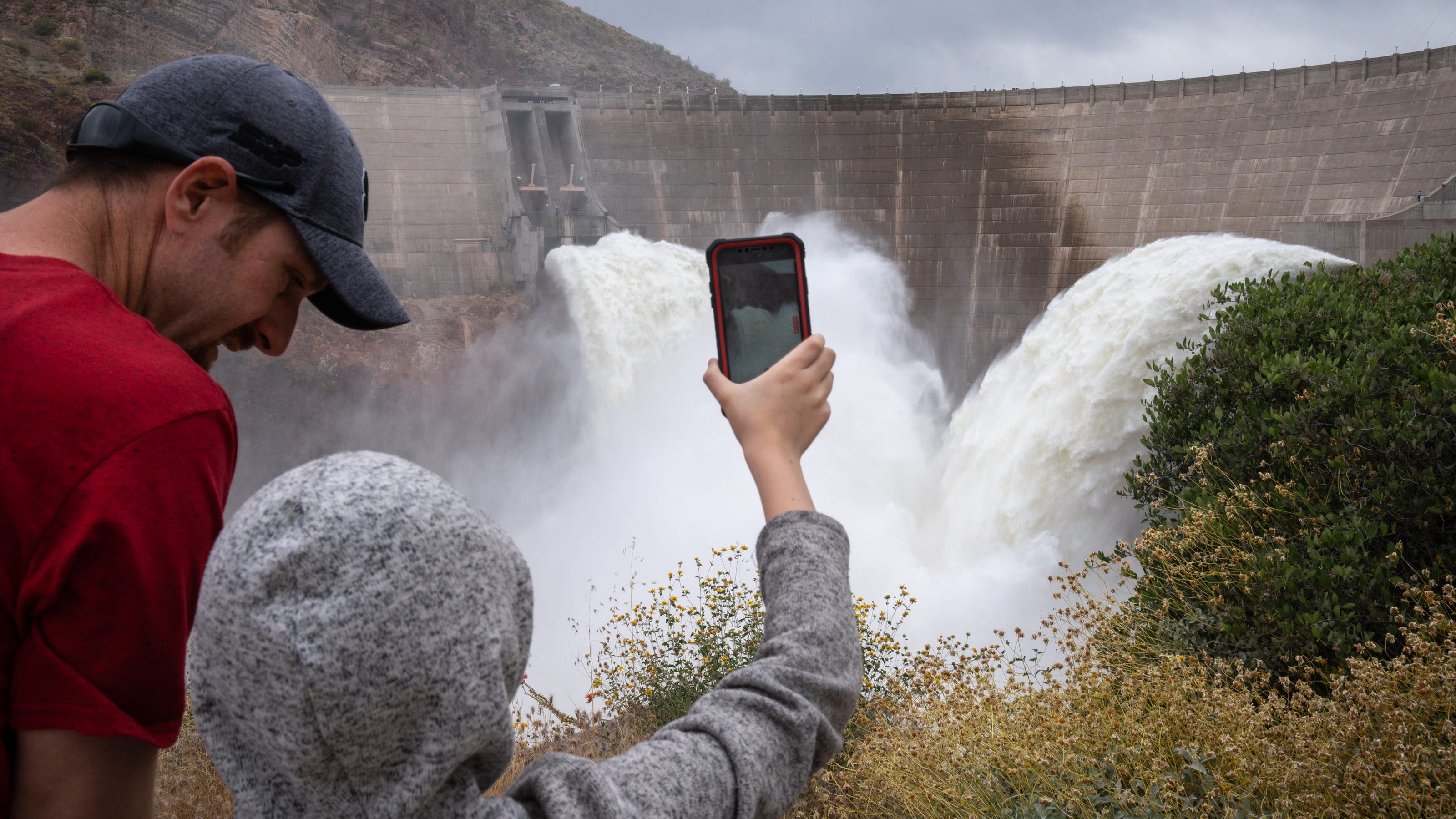
Some 650 million gallons, or 2,000 acre-feet in the language of water managers, was destined for capture and retention by smaller dams downstream. But the release was the last of some 300,000 acre-feet that SRP has released to make room for this year’s snowmelt, water supply manager Charlie Ester said, and much of that has washed past the dams and through the normally dry Salt River bed.

Together with water from the Verde River, SRP has released more than 700,000 acre-feet down the river, nearly as much as the 750,000 acre-feet or so that it delivers to users in a year.

The water isn’t wasted. Some of it replenishes the aquifer that SRP and others will later pump and use. And this year, for the first time in more than a decade, there’s so much flowing from the Salt to the Gila River that the water is temporarily reaching clear across the Sonoran Desert to its confluence with the Colorado River, near Yuma.

There, Ester said, it could help the U.S. meet its water treaty obligations to Mexico while easing demands on Lake Mead.

It also should aid some desert wildlife and lingering migratory birds in the short term, said Tyler Williford, an Arizona Game and Fish Department biologist in Yuma. He had not yet heard any reports of people fishing in the normally dry channel, he said, but the flows could continue for a couple of weeks.
 
90 years ago the Great Depression and dust bowl caused land use changes in the US. White oaks reclaimed some marginal farm fields. For the next decades white oaks were abundant and increasing. Decades ago that uptick reversed and now there is deficit of white oaks and it threatens the bourbon whiskey makers, who need a new barrel for every batch of whiskey.

You could probably come up with a climate change explanation for the increase in white oaks (trees love C02!) but the better explanation is the land use changed, acorns got buried in fields, and thrived there.

Likewise, there is a legacy of dam building, causing water abundance, causing population increase, causing water to be less abundant, causing problems. That’s a resource cycle. Practically every finite resource follows that cycle. They tend to play out over 75-100 years. Big Cycles.

Solving climate change won’t bring the water back. It would be the end of a cycle though.

We nearing the end of the oak tree, water use in 7 US Western states, Federal debt, and I wonder how many other cycles.
 

May 22, 2023

Sent via Electronic Mail

Camille Calimlim Touton, Commissioner
U.S. Bureau of Reclamation
1849 C Street NW
Washington, D.C. 20240

Dear Commissioner Touton:

The Colorado River Basin States Representatives of Arizona, California, and Nevada (Lower Division States) have reached an agreement to conserve at least an additional 3 million acre-feet (MAF) of Colorado River Water in the Lower Basin by the end of calendar year 2026, with at least 1.5 MAF of that total being conserved by the end of calendar year 2024 (Lower Basin Plan). We request the Lower Basin Plan be fully analyzed as an action alternative in the Bureau of Reclamation’s (Reclamation) Near-Term Colorado River Operations Draft Supplemental Environmental Impact Statement (Draft SEIS), published last month.

Throughout this process, and as affirmed at the time the Draft SEIS was announced last month, the Lower Division States Representatives remained committed to working together and with Reclamation to develop agreement(s) that meet the purpose and need of the Draft SEIS to “modify guidelines for operation of Glen Canyon and Hoover Dams to address historic drought, historically low reservoirs, and low-runoff conditions in the Basin” (Draft SEIS, Section 1.3). We believe this proposed action alternative both meets the purpose and need of the Draft SEIS and, when analyzed, will be shown to perform equally or better than the action alternatives originally proposed by Reclamation. TheLower Basin Plan does not require any unilateral exercise of federal authority to achieve these levels of conservation.The terms of the Lower Basin Plan are as follows:

1. This Lower Basin Plan does not require the Secretary to unilaterally exercise her authorities to implement reductions and it does not contemplate any waiver of these authorities to protect the Colorado River system in the future if hydrological conditions require such action.

2. Tier-based reductions and contributions in the remaining interim period (2023 through 2026, inclusive) under this alternative shall be limited to the existing 2007 Interim Guidelines, the Lower Basin DCP, and Minute 323.

3. At minimum, System Conservation (in lieu of additional reductions) achieved in the remaining interim period (2023 through 2026, inclusive) shall be at least 3 million acre-feet (MAF) of which at minimum 1.5 MAF shall be physically conserved by the end of calendar year 2024.

4. In aggregate (understanding that each contract is different and will have user-level limitations), compensated System Conservation shall be mandatory, enforceable, measurable, verifiable, and non-retrievable.

5. System Conservation up to 2.3 MAF will be federally compensated under Pub. L.117-169 Inflation Reduction Act Title V, Subtitle B, Part 3 “Drought Response and Preparedness” Section 50233 "Drought Mitigation in the Reclamation States” (IRA Funding).

6. The remaining required System Conservation may be in whole or in part compensated by state and/or local entities or be uncompensated. To the extent that System Conservation is federally funded with non-“Bucket 1” IRA Funding, such as under “Bucket 2” IRA Funding, or under Pub. L. 117-58 “The Bipartisan Infrastructure Law” Title IX “Western Water Infrastructure”, that System Conservation may offset up to 0.2 MAF of the remaining required System Conservation.

7. All or a portion of the remaining required System Conservation may be offset with ICS created in 2023-2026 and for any such ICS the creator cannot order delivery of, transfer, or assign the ICS at any time before December 31, 2026. Because of the limitation on ICS storage space, some DCP ICS will become system water, which is an uncompensated addition of system water.

8. If the April 24-month Study “Minimum Probable” model in 2024, 2025, and 2026 indicates that the respective end of year elevation in Lake Mead will fall below 1,025 feet, the Lower Division States will have 45 calendar days from the publication of the respective 24-month Study to propose, after consultation with the Upper Basin States, an implementable plan to Reclamation to protect Lake Mead from reaching an elevation of 1,000 feet. If such an acceptable plan, as determined by Reclamation, is not developed, Reclamation may independently take action(s) to protect 1,000 feet.

9. Glen Canyon Dam operations in the remaining interim period (2023 through 2026, inclusive) under this alternative shall be consistent with the existing 2007 Interim Guidelines and the DCPs except as modified in this term 9.

Subject to the Secretary’s authorities described in term 1, Lake Powell releases will occur as specified under the 2007 Interim Guidelines except that when Lake Powell is in either the Middle Elevation Release Tier or Lower Elevation Balancing Tier, a mid-year adjustment can be made to reduce the release to an annual volume not less than 6.0 MAF if there is a possibility of the Minimum Probable scenario in any 24-month study of Lake Powell dropping below 3,500 feet in any of the upcoming 12 months that cannot be avoided by modifying monthly release volumes without changing the annual release volume.

This letter is being submitted concurrent with a letter from all Seven Basin States requesting a suspension of the current Draft SEIS comment period to fully analyze this proposed action alternative, the continuation of our productive relationships with Mexico, an expedient start to the development of the post-2026 operating guidelines, and a firm recognition that recent hydrology does not override the longer term challenges the basin is facing. The Lower Division States stand ready to support these efforts and look forward to our continued cooperation with Reclamation and the Upper Division States on these critical actions.

Respectfully,

Thomas Buschatzke, Director
Arizona Department of Water Resources

J.B. Hamby, Chairman & Commissioner
Colorado River Board of California

John J. Entsminger, General Manager
Southern Nevada Water Authority
 
Maybe not the dam itself, but the distribution and pumping stations. Imagine many valves downstream opened up or having water sent to the wrong place.
 
Maybe not the dam itself, but the distribution and pumping stations. Imagine many valves downstream opened up or having water sent to the wrong place.
Electrical infrastructure is far more computerized and vulnerable than hydrological; you can destroy electrical infrastructure in milliseconds.

Water is far more low-tech than you think, and if water spurts out somewhere, it's less likely to do damage before it gets noticed.
 
"Still, the drought deficit is so large, experts say the West would need four or five more years of snowmelt like this year’s to really fill up Powell and Mead."

htps://www.cnn.com/2023/06/24/us/how-much-lake-mead-water-rise-climate/index.html
 
Back
Top